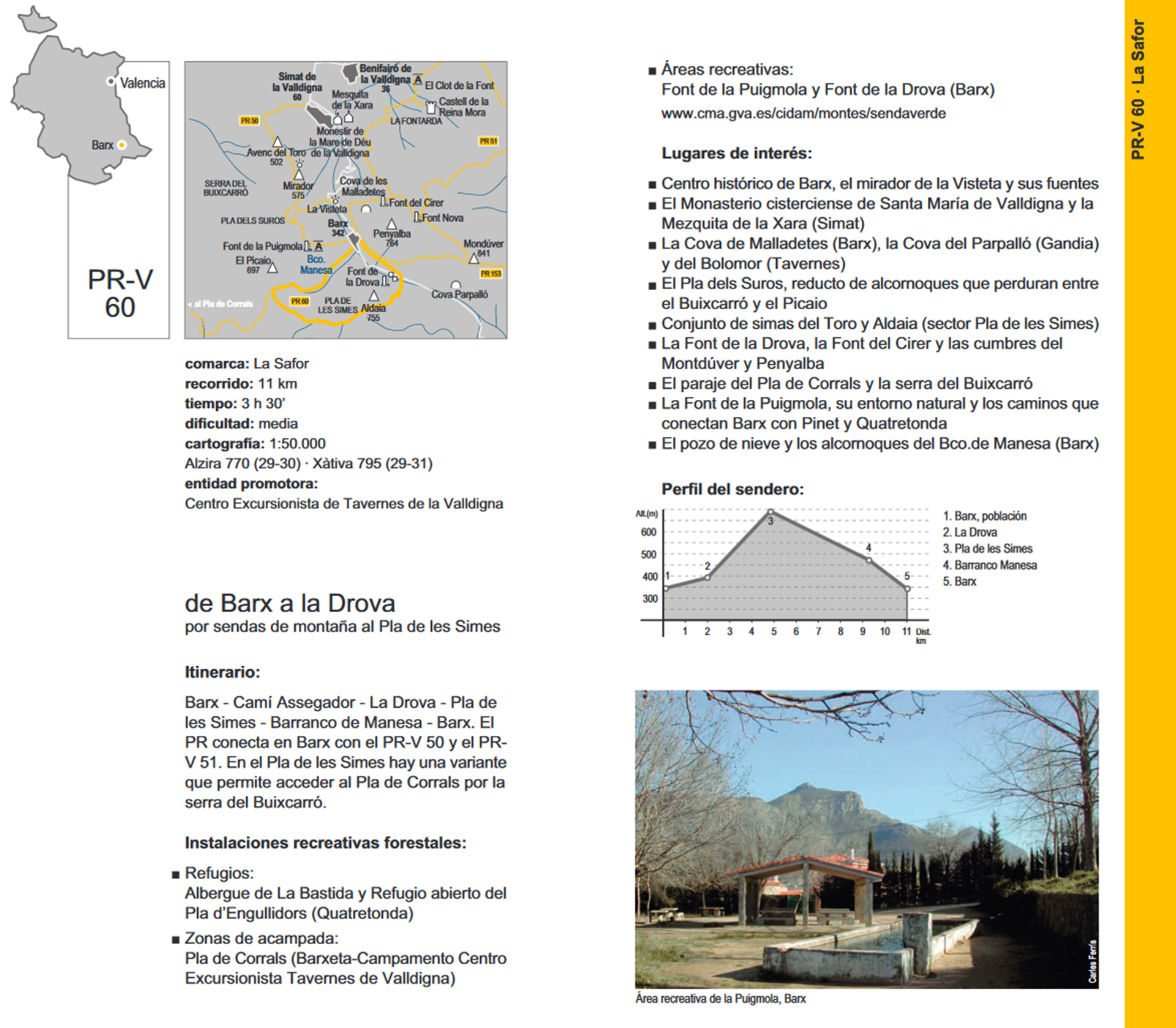
Traditional name. Senda d’Aldaia
Tour. 12. 2 km.
Time. 3 h. 30’.
Difficulty. Medium.
Difference in altitude. Among the 325 m. in the town of Barx and 755 m. at the summit of l'Alt de l'Aldaia.
Description of the itinerary.
South of the town of Barx, we can distinguish perfectly the majestic silhouette Massif Buixcarró, through which runs the entire route of the trail PR-CV 60, begins south-east of the town, pass the bridge over the ravine of the drova des carrer Lepant, where is the information panel the entire route of the trail and the first sign opposite the ecopark.
Going up a dirt road toward the foot of the mountain, we reach the junction with the road to l'Assegador (former Real Cañada de Castilla), road used during the Middle Ages and Modern Age for the transit of cattle.
We continue left on the road with this direction until you reach the source of the Drova, a recreational area where you can admire the landscaped beauty of its surroundings and enjoy the freshness of its waters. We follow the path east and within minutes we reached them Basses of Drova (s. XVIII), built by the monks of the Monastery of Valldigna, to irrigate the fields.
Continuing to the crossroads with the path, at this junction along a path that goes to the left we can reach them Cases of Drova, they were built by the monks (s. XVII) for summer residence and provide shelter for workers their land, stands the sundial of 1799. continuing to the right and a mountain path, we passed the source of Mongeta, the road begins to gain altitude on the mountainside and continues picking gap, we the gap Forat de l'Air, we continue along the hillside and down to find the middle of the ravine along which the path to reach a junction. Continue on the right until the next crossing, left the plain Nevereta, right to the top of l'Aldaia 755 m, round trip, where we can admire the stunning views of the Mondúber massif, Valley barx, the Mediterranean coast and the inland mountains. If we continue to reach the Sima de l'Aldaia.
Continuing on the main path to the west at the next intersection, on the left connected with the forest track to Pinet, following the path which already loses height until reaching the plain Nevereta, left and along the forest track It leads to the junction with camí de l'Assegador and font of Benita.
Plain Nevereta, which gives its name to the fridge (s. XVIIl) that is used to store snow during the winter. The path down the ravine Manesa, declared by the Generalitat Valenciana as a zone of Micro Flora Reserve for the important cork oak forest and ferns all we can see the path that runs through the inside of the ravine. Without reaching the end of the gorge we continue along a path well defined through the forest of pine and Aleppo, to the junction with the road Pinet, Benita source, path of l'Assegador, Barx.
Worth appoint a very unique and historical element, such as Refrigerator (s. XVIII), we can see the end of our tour, forest track, road de l'Assegador and Benita source, following the path of Pinet towards the town of Barx.