Outdoor activities
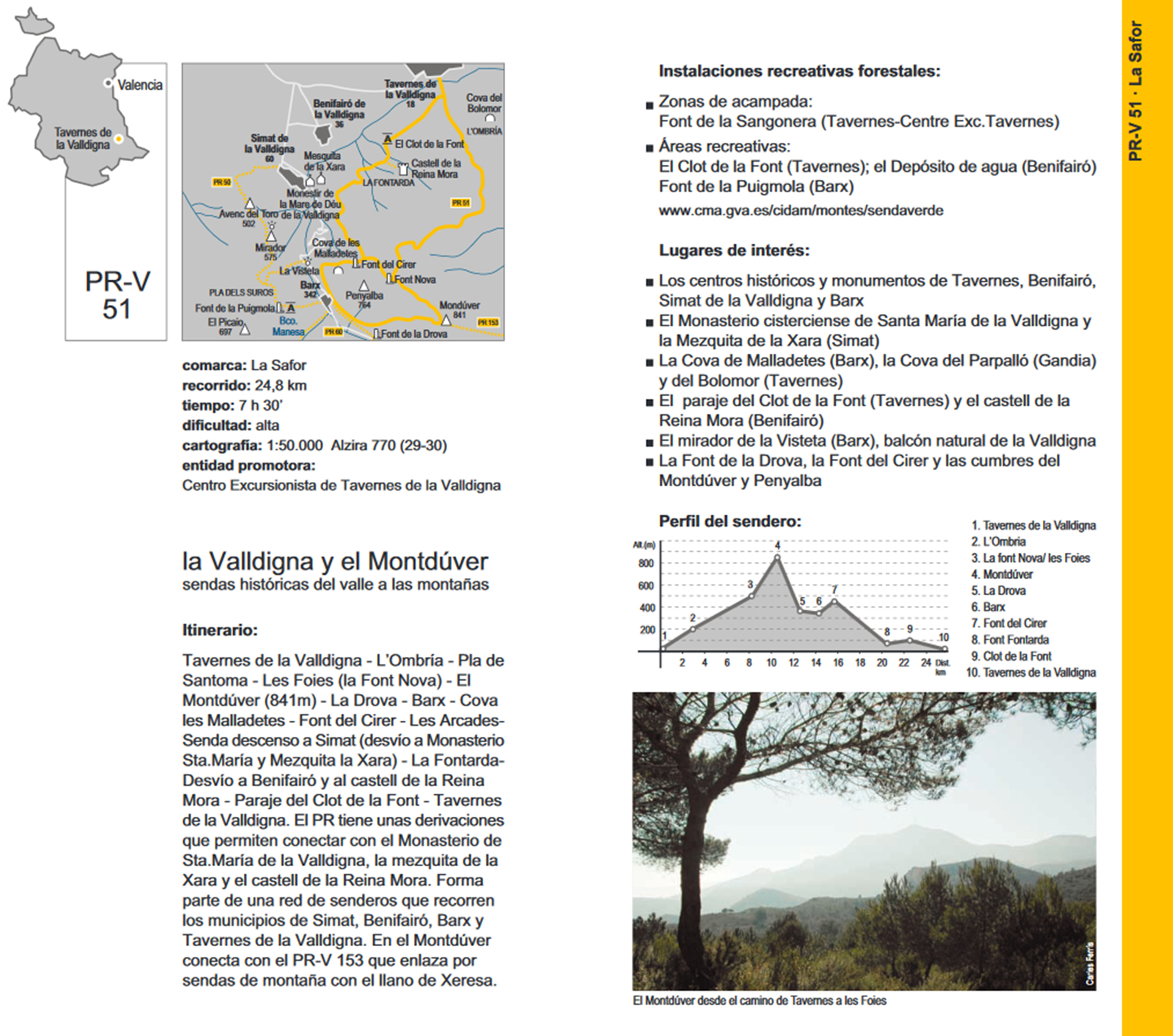
Route PR-CV51
Traditional name. RUTA DE LA VALLDIGNA.
Tour. 26.5 km.
Time. 7 h 35’
Difficulty. High
Difference in altitude. Among the 17 m. in Tavernes, and 843 m, at the top of Mondúber.
Description of the itinerary.
It is undoubtedly a real privilege to start a tour of the region Valldigna, from such a historic landmark as Monastery of Santa Maria de Valldigna place. Founded by King Jaume II Juts the March 15, 1298, promulgated the order granting land to the abbot of Santes Creus for the new foundation of a Cistercian monastery.
Just Portal Monastery where we can see how highlighting the heraldic shields of Valldigna and its founder abbot, we climbed Street Barx, turning off to the left and continue on the path of the Xara, and part of the wall of the monastery enclosure. At the end of the wall and to the right is a path that leads in minutes to the shrine of the Xara. Continuing along the asphalt road we reach the Fontarda, natural spring and place that delimits the municipalities of Simat and Benifairó de la Valldigna. Continuing and within the term of Benifairó of the Valldigna by the way of Fontarda until you reach a crossroads, continue to the right on a dirt road, turning aside for caminal to the right leads to the skirt mountain, limit terms of Benifairó and Tavernes. We continue along a path that runs along the mountainside to the spot and source of Clot de la Font, a recreational area equipped with plenty of water. We continue east on the paved road Clot direction to the junction with the road Cadira, right up to the foot of the mountain and a trail that climbs zig-zag to the top of the mountain l 'Ombria. We continue along a forest dirt track to the junction of another forest track with a bad firm asphalt, right we can see an abandoned television relay station, the trail already in municipality of Xeraco, we continue to re-enter the municipality of Benifairó of the Valldigna, we went through the intersection of track to the source of Madallars, follow the path to a junction with trail, continue left along a well defined path to the connection with the road Mondúber up to the peak, there are some uphill sections to the peak that runs along the old path of Mondúber, before the construction of the road to the summit of Mondúber of 843 m.
From the junction of the road with the path, down the entire road we reached the steep streets of urbanization of the Drova and down the street d'Esparterola, to the intersection of the Rue de l'Alacra, at the end of the street we continue for Vell path a path of Drova and a small way to access a chalet-shaped tower and a path we reached the town of Barx, through its Calvary. And within the population and the street Jesus Roig and Calle Calvari to the junction with Calle de la Font, we left the population towards the CV 675, a few meters from the exit of the village on the right inside a farm , we take a path to connect with them Foies road continuing to the Font del Cirer.
Opposite the source is a trail zig-zag (camí dels Burros), down to the end through les Arcades, reaching the junction with the CV-675, we continue about 200 meters and left out the way dels Brolls we take the population of Simat de la Valldigna, facing us perfectly distinguishes the grandeur silhouette Monastery Santa Maria de Valldigna, end of our journey.
